Aerial Views & GPS Coordinates, Lake Murray State Park, OK
Lake Murray Resort "Official" map | GPS coordinates file |
 PDF map of the offroad vehicle area, divided into 16 pages for ease of printing. Users can print, cut, and tape together for a big map. |
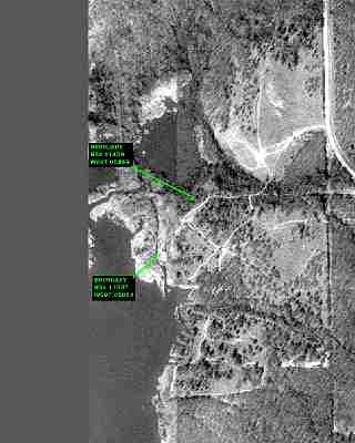
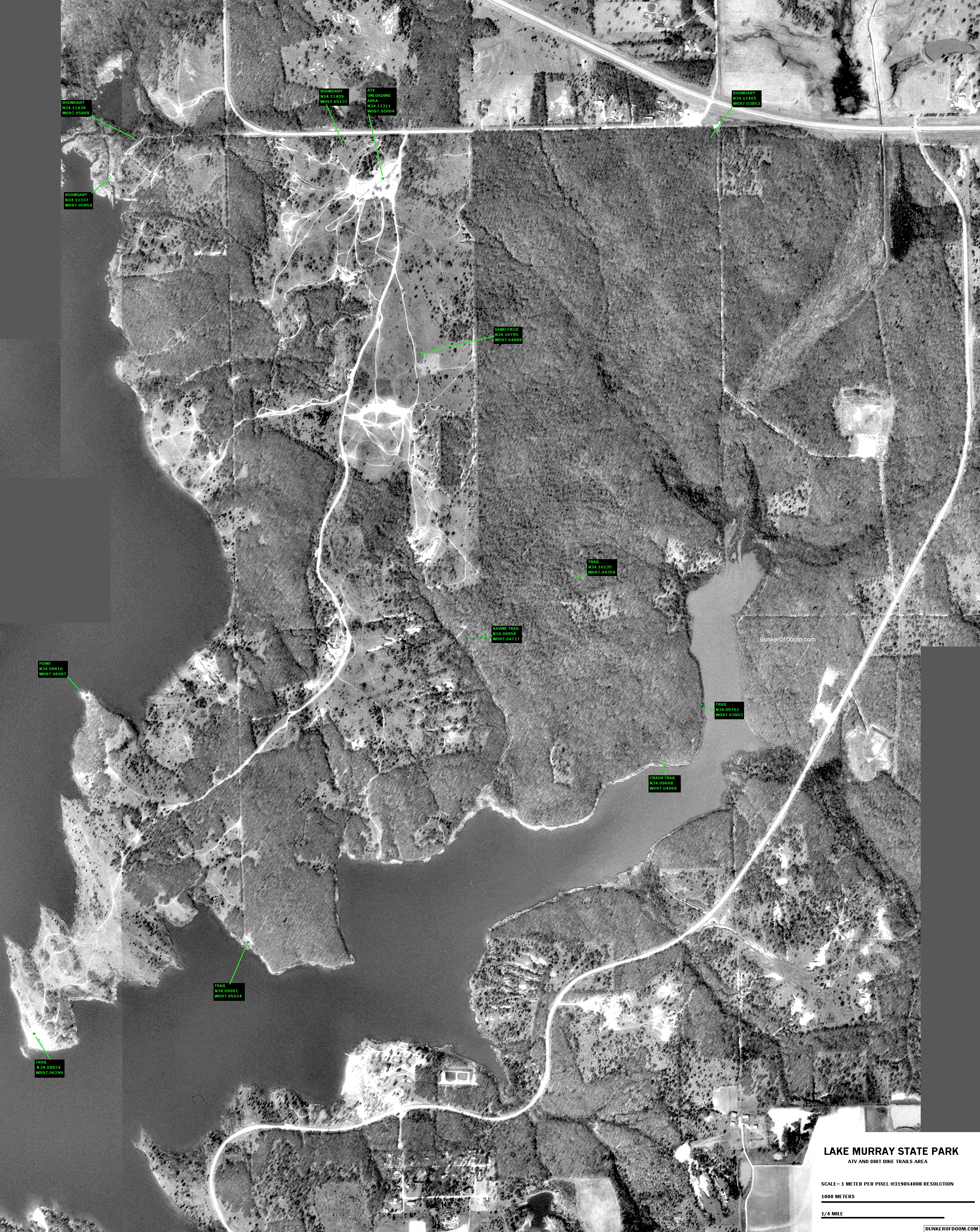 1-meter per pixel aerial view of the offroad vehicle area as 256-color (255 gray scale and 1 green for labels) GIF. 3190x4008 -highest resolution for the largest plotters/printers like at Kinko's. |
 PDF map of the offroad vehicle area -same as the 16 page map, but as one very large page. |
|
1-meter per pixel aerial view of the offroad vehicle area as zipped bitmap. 3190x4008 -highest resolution and deepest gray scale. This is mainly for downloading and adding your own GPS points to, or to take to Kinko's for the best quality print on large-format plotters/printers. |
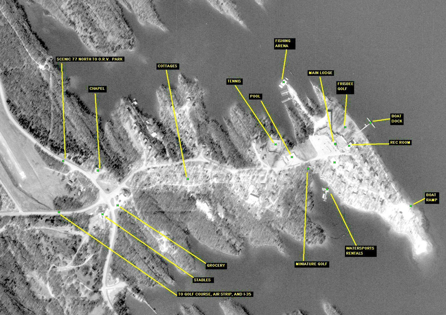 1-meter per pixel aerial view of the lodge area |
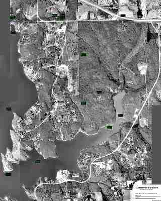
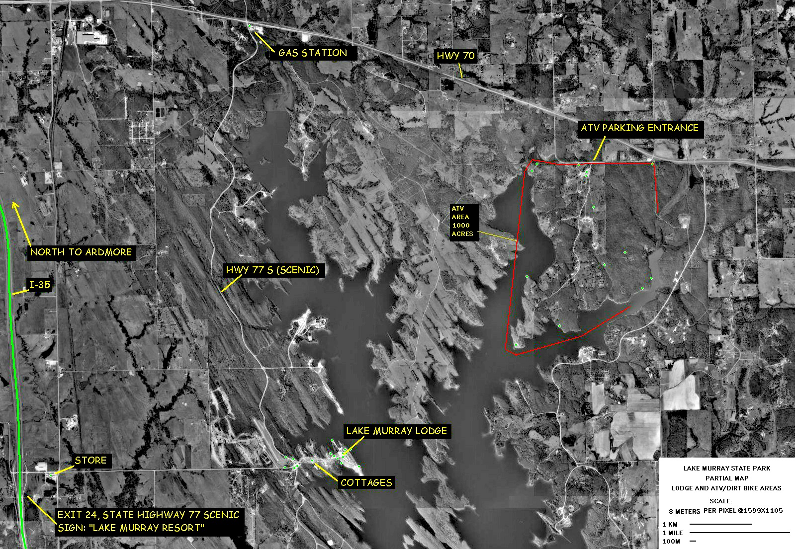 8-meter per pixel overview, shows I-35 and how to get from the lodge area to the offroad vehicle park. |